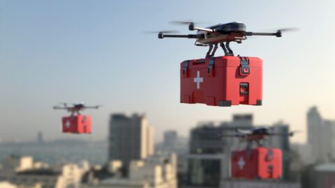
A drone will transport goods from Den Helder to the Wadden island of Texel for the first time on Wednesday 3 August. The flight will take place from the METIP Den Helder, dropping off the cargo at NIOZ, the Royal Netherlands Institute for Sea Research.
The ANWB and PostNL previously conducted test flights with medical transport by drone between hospitals in Meppel and Zwolle. METIP is using the experience and results of this research to set up its pilot project. In this pilot, drones transport emergency shipments to the Wadden Islands. This transport is currently still much done via helicopters. Using these is not only more expensive than a drone, but also has a greater impact on the environment.
Long Distance Cargo Drone Delivery project
This is the first flight from the mainland to a Wadden island. The pilot is part of METIP's 'Long Distance Cargo Drone Delivery' project. Within this project, METIP is investigating the use of drones and other unmanned systems for maritime transport, logistics and both inspections of and maintenance on offshore structures. These include production platforms and the growing number of offshore wind farms in the North Sea.
The drone used by METIP for the pilot is a VTOL drone, where VTOL stands for Vertical Take-Off and Landing. The drone takes off from the northernmost point on the North Holland mainland: at the Den Helder sea promenade. From this location, the drone will fly to NIOZ on Texel.
Conducted with DroneQ Robotics and Airhub
DroneQ Robotics is carrying out the flight in cooperation with Airhub. DroneQ Robotics is an unmanned robotics systems operator and integrator. METIP's knowledge partner includes branches in the Netherlands, including Den Helder. The company supports ports around the North Sea, other ports, the offshore energy sector and related industries in their pursuit of climate neutrality. DroneQ Robotics does this by implementing unmanned robotics technology.
Airhub supports companies and governments in implementing drone operations. The company has developed an app integrating all necessary and required preparation and implementation for safe and legal drone flying. Like DroneQ Robotics, Airhub is a partner of METIP.
EVLOS mode
During its flight, the drone will traverse controlled military airspace, which is also known as a military CTR (controlled traffic region). The flight takes place in a so-called EVLOS mode, which stands for extended visual line of site. Observers hereby monitor the drone from a distance, something that requires regulation. With the help of the test flight, METIP aims, among other things, to provide insight into ways to fly effectively and efficiently, commercially and socially within the applicable regulations.
The flight is also being used as part of the WATLAS (Wadden Sea Advanced Tracking & Localisation of Animals in real-life Systems) research programme. Using WATLAS, NIOZ is tracking birds in the western part of the Wadden Sea. By mapping where birds fly to and why they do so, NIOZ aims to understand how birds cope with threats such as rising sea levels and habitat destruction. The project focuses on tracking the red knot, the sanderling, the bar-tailed godwit and the common tern.
Soil sample and bird tag as cargo
On the outward flight, the drone will transport a soil sample taken on the mud flats. This sample is destined for researchers at NIOZ. On the return flight to Den Helder, the drone transports a small transmitter, also called a bird tag. This can be attached to birds to track them. In this way, NIOZ wants to collect data on the transmitter's range. NIOZ is also involved in developing guidelines for flying over the Wadden area.
Author: Wouter Hoeffnagel