It looks like entrepreneurs will also be able to call themselves data specialists in the near future. Various initiatives from the Netherlands and France, among others, are making it possible for agricultural companies, among others, to collect extensive data on their livestock, for example.
In the Netherlands, Magnitude Space is on a mission to provide insight into Earth's information via dozens of mini-satellites and a sensor system. The startup wants to launch 48 mini-satellites - measuring 10 by 20 by 30 cm - into space by rocket. It plans to fly the first one as early as the end of 2017. Then, millions of sensors, spread all over the earth, will contact the satellites. The satellites will in turn transmit the GPS data to eight ground stations, which will make the data available to users via the cloud.
Gap in the IoT market
Magnitude Space thinks it has found a gap in the Internet of Things (IoT) market. Until now, there was no way to provide cheap insight into data on the ground. Magnitude Space thinks it can offer that because their satellites fly much closer to earth and are cheaper than regular satellites. Magnitude Space customers choose which sensor system they want to work with.
The co-ceo of Magnitude Space, Laurens Groenendijk, stressed in an interview with Sprout.nl that their satellites are not only of interest to the livestock and agriculture industry. For instance, the company is going to set up a project with weather stations in Africa. By connecting sensors throughout Africa to the Magnitude Space system, weather measurements can be taken quickly outside the GSM network (which far from everyone has access to). In Indonesia, they are in talks with parties that want to equip wooden fishing boats with a sensor to monitor whether people are fishing in illegal waters. But an entrepreneur in portable toilets also seems to be interested in the system. "Of the 12,000 Dixies he rents out every year, he loses a few hundred. That will soon be solved with a 15-euro sensor."
Magnitude Space has now secured a million euros in investment. For instance, telecom investors have put money into it and the startup receives funding from the Dutch government, with approval from the European Space Agency (ESA). ESA is also collaborating on the technology.
Insight
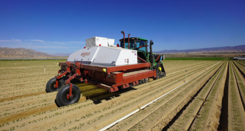
A new initiative has also been set up in France to make data available via satellite imagery. However, the IT company Atos is explicitly targeting the agricultural sector with its Atos Codex service. For example, the technology makes it possible to use the right amount of fertiliser in the right locations, at the right time, in a relatively simple way. This speeds up the process and allows a farmer to work in a much more targeted way.
According to the IT company, farmers can now manage resources more efficiently, reducing costs by 15%. In addition, crop quality will also increase, resulting in a better harvest. Farmers will also gain greater insight by learning from the data, expanding their knowledge.
By: Kelly Bakker
Source photos: Pixabay